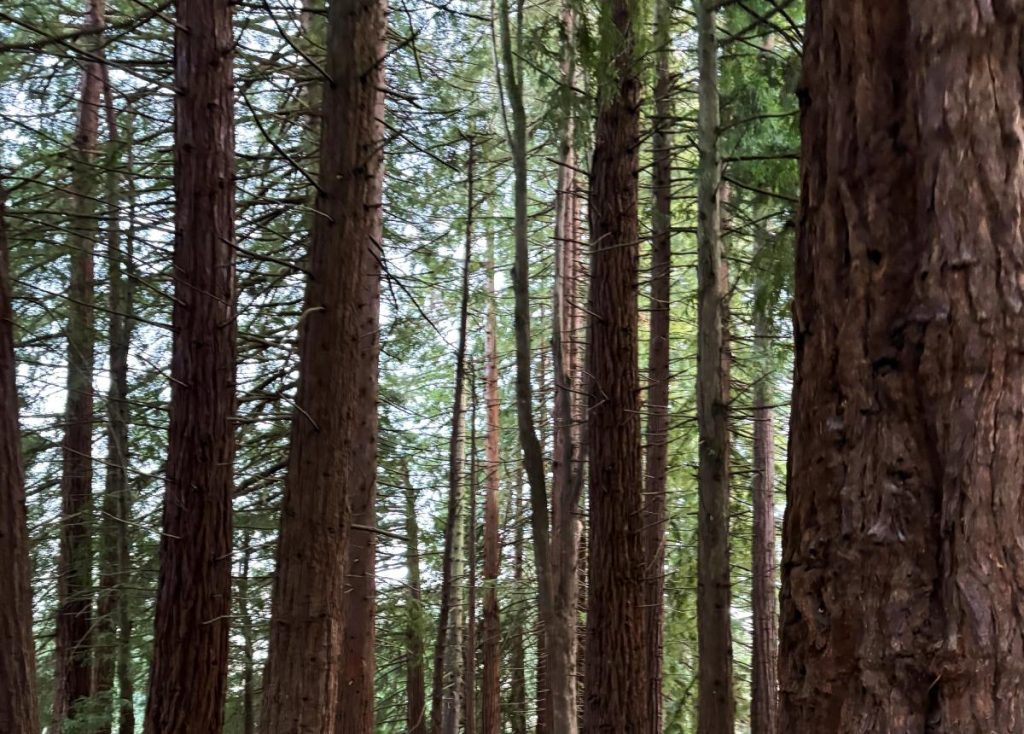

Marbled murrelets (Brachyramphus marmoratus) are an endangered seabird. They are also an elusive seabird. They feed off the coast of the northern Pacific ocean, but nest in the coastal forests where they have proven difficult to find. Because of its endangered status, protecting the habitat of this bird is a priority of coastal regions such as Grays Harbor County. A forestry department in Grays Harbor County is seeking a Safe Harbor Agreement to help protect the marbled murrelet, but they need to know where the habitat is in order to protect it. Because of the elusive nature of the bird, this is more easily said than done. Surveying all the timberlands for a bird that’s exceedingly difficult to find would be a massive undertaking, so as with many things in today’s world, we turn to computers. We can’t find the actual birds with the computers, but we can look for places where marbled murrelet habitat MIGHT be found. If there’s high-quality habitat present, there’s a much greater chance that there may be marbled murrelets present too.
We know that marbled murrelets nest in large trees. We also know that large trees tend to occur in older forests. So we made the assumption that if we can identify older forests, then we can identify forests that might have high-quality marbled murrelet habitat. Older forests tend to have taller trees than younger forests, simply because the forests have been there long enough for the trees to grow very large. Older forests also tend to have a characteristic that we refer to as “structural complexity”. When we look for structural complexity, we look at the tops of the trees. We can think of this as a surface, such as a road. A brand new road would be recently paved and it would be smooth. This is not structurally complex, and this is how a young forest appears: level across the top. As roads age, they develop cracks and potholes and they become less smooth, more varied. Forests are the same way: they develop more variability as they age, so this increased structural complexity is indicative of older forests.
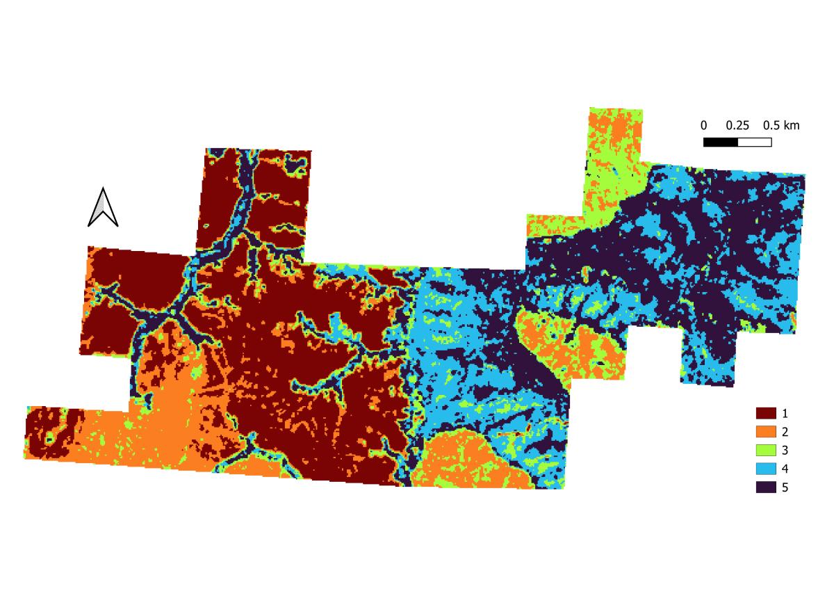
We used a canopy height model (a map of the tops of trees) to locate regions that have both the tall trees and the high structural complexity that are characteristic of older forests. We examined the map in 30 ft x 30 ft areas (pixels). For each pixel, we calculated the maximum tree height within the pixel. By using maximum height, we focused only on those largest trees on the landscape where the murrelets could nest. Measuring structural complexity is a bit more complicated. We used a metric called the vector ruggedness measure (VRM). In calculating VRM, the computer draws many 3-D arrows between adjacent points on the canopy height model. If these arrows are longer it means that there is more variability in heights of adjacent pixels, indicating for example, a tall tree next to a short tree. These values get converted into one metric ranging from 0 to 1 where 0 represents no structural complexity and 1 represents extremely high structural complexity. Once we had a maximum canopy height and a VRM measure for each pixel, we grouped the pixels into 5 clusters based on similarities within the two metrics.
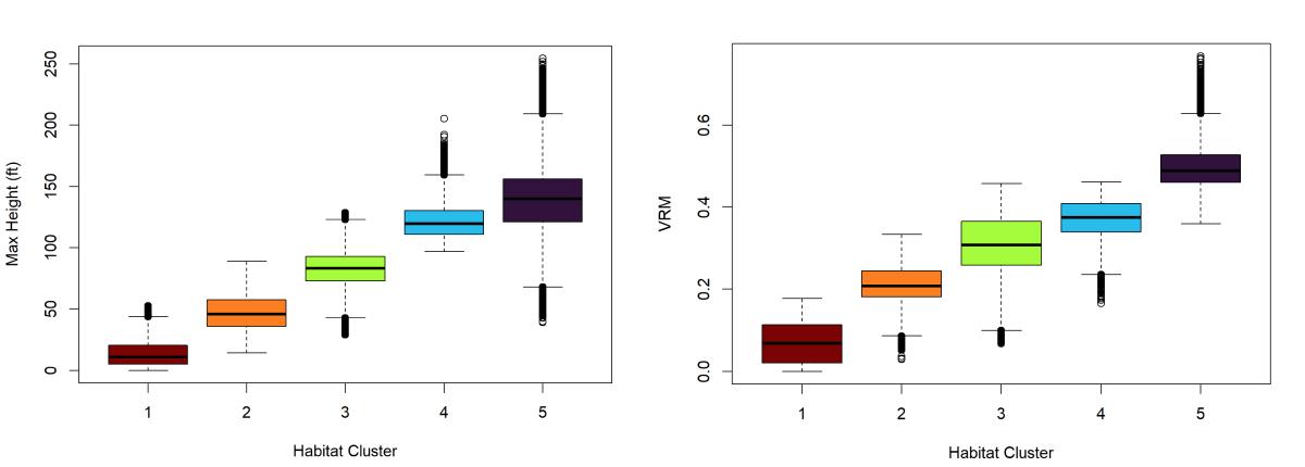
Now, what does this mean for the marbled murrelet? Simply, the potential for finding high quality habitat increases through the clusters. Cluster 1 had very short trees and a very smooth canopy surface (VRM), indicating that pixels found in Cluster 1 contain young forests. Young forests are not ideal marbled murrelet habitat, so we classified Cluster 1 as forests that are very unlikely to contain high-quality marbled murrelet habitat. We considered pixels in Cluster 5 as forests that very likely contain high-quality marbled murrelet habitat because those pixels had both the tallest trees and the most structural complexity.
One may notice that some pixels from Cluster 5 had somewhat low maximum heights. How come we can still call that high-quality habitat? One will also notice that there are no pixels with low VRM (structural complexity) in Cluster 5. So while it isn’t unreasonable to think that there may be a 30 ft x 30 ft patch in an old forest that only has short trees, it is very unlikely that we would find this high structural complexity in a very young forest. Conversely, in Cluster 4, there are some trees with higher maximum height but lower VRM. This likely indicates that some trees in the forest are starting to get pretty big, but that the structural complexity isn’t widespread enough yet for us to label those as older forests. But left alone, they could become that old. It just goes to show the importance of using more than one measure in drawing conclusions!
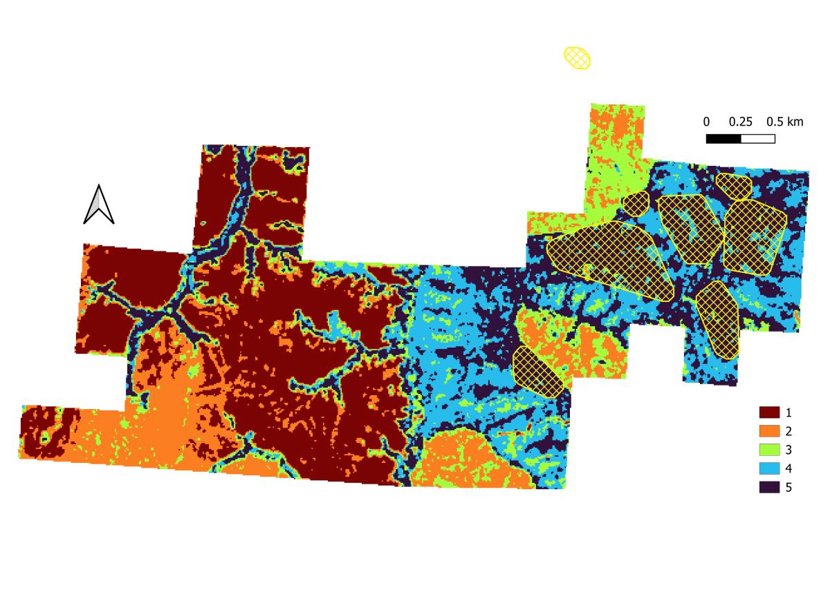
Legally, large trees are not the only requirement for a forest to count as good marbled murrelet habitat. Forest Practice Rules define marbled murrelet habitat as an area that is 300 feet across in every direction, convex (think circular) and at least 5 acres in size (of course this isn’t just any random 5 acre circle, it still has to have the big trees and structural complexity!) The areas that our clustering determined as older forest do not necessarily fit these shape criteria (Figure 2). Therefore, we needed a way of filtering or reshaping the regions that our clustering determined to be high-quality habitat.
To address the 300 foot criteria, we used image analysis. Image analysis processes use a filter to select or reject segments based on size. We set our circular filter at 330 feet to avoid overestimation. Our first process used the filter to eliminate segments that were < 330 feet across. This ensured that everything that was left met the width criteria. Because the filter was circular, we knew that everything left was at least 300 feet in every direction. Our second process allowed the patches to swallow small patches (< 300 feet) of a different cluster that fell in the middle of a swath of cluster 5. One, or two, pixels of a different cluster within a larger area of cluster 5 are just structural complexity on a larger scale.
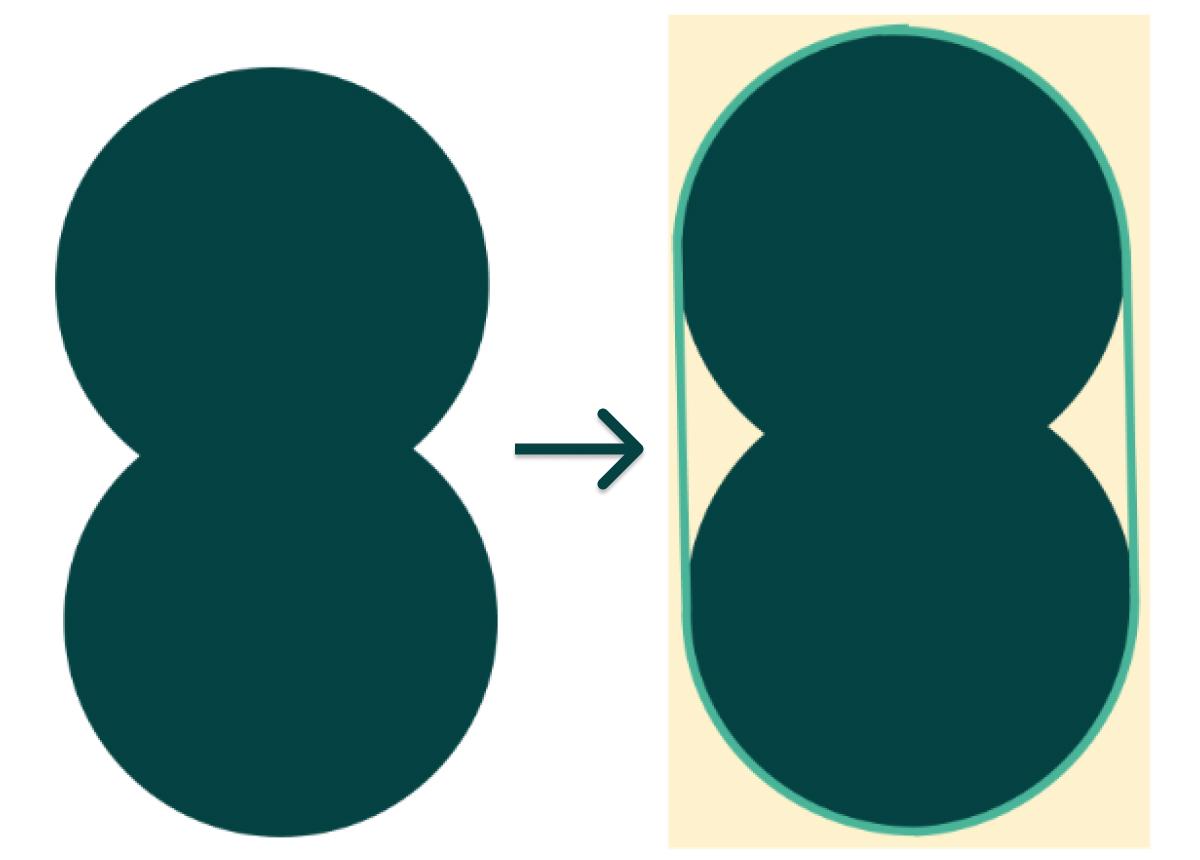
To meet the convex requirement, we used a process known as a convex hull. This process effectively shrink-wraps a shape. It makes the shape larger by smoothing over any points where the shape dips in towards the center (Figure 3). There was some overlap in patches once we applied the convex hull process. Again to avoid overestimation (you can never be too careful!), we dissolved the overlapping patches so that they combined into one larger polygon. This resulted in some polygons that no longer met the convex requirement. Consider a Venn Diagram: at the point where the two circles (each is a convex shape on its own) meet, the corner points into the middle of the combined shape. To fix this, we reapplied the convex hull process. After this second application, there were no more overlapping polygons, so we had our regions of high-quality marbled murrelet habitat that met all the requirements. Lastly, we removed any patches that were less than 5 acres. You can see the culmination of all these processes in Figure 4.
Ultimately, this analysis identified 93 potential patches within the timberlands that may contain high-quality marbled murrelet habitat. Now, the folks in Grays Harbor can set out to look for marbled murrelets with a much better idea of where they could find them. Hopefully when they visit these areas, they will find evidence of marbled murrelets activity, or maybe even find a marbled murrelet! Any of this evidence could help the forestry department in Grays Harbor County get their Safe Harbor Agreement which would increase protections for this endangered bird.